


The National Weather Service has issued a number of advisories and alerts
Update 12:59pm: Radar map from the National Weather Service shows the future path of the storm.
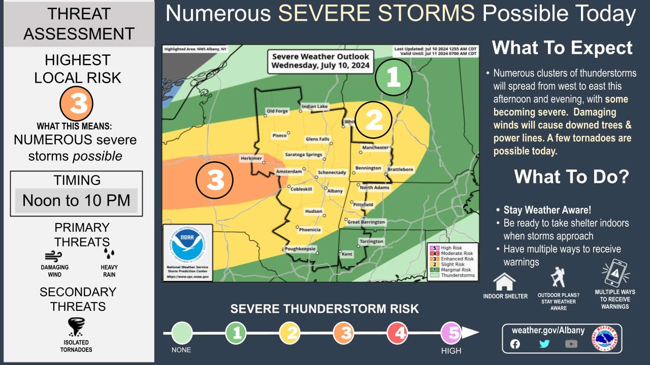
Tornado Watch issued for parts of our region until 9 PM. Isolated thunderstorms are possible this afternoon. Organized line of storms develops in western NY, tracks east through evening that has the best chance at producing severe weather. Forecast model shows timing of storms. pic.twitter.com/sOEN12qneB
— NWS Albany (@NWSAlbany) July 10, 2024
Update 12:54pm: A confirmed tornado has touched down south of Buffalo and more warnings have been issued Oneida and Madison counties.
Update 12:36pm: The National Weather Service has issued a Tornado Watch for most of the Capital Region, Mohawk Valley and North Country until 9pm Wednesday
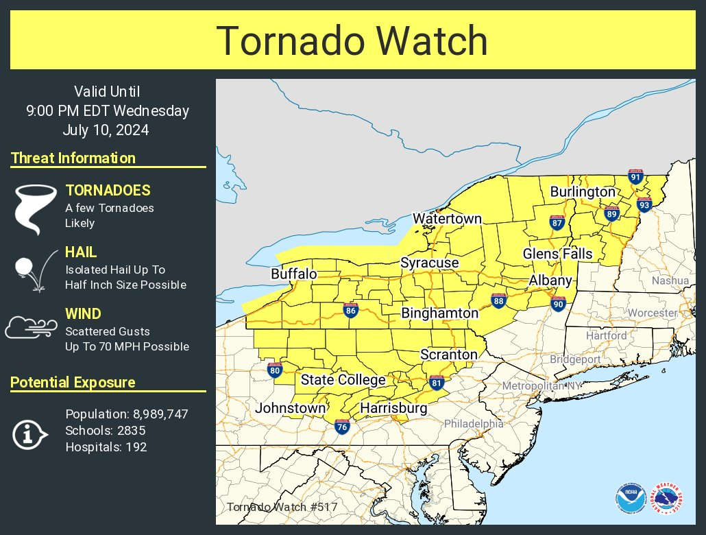
The remnants of Hurricane Beryl will be pushing through New York State on Wednesday. It is expected to hit the Capital Region during the afternoon hours, carrying into the evening. Strong winds, heavy rain, potential flooding and the possibility of a tornado are all factors that should be expected as severe weather will likely impact most of the area.
The National Weather Service has issued a Hazardous Weather Advisory for the Capital Region, while much of the area continues to remain under a Heat Advisory. A Flood Watch is in effect for Fulton, Montgomery, Warren and parts of Washington County.
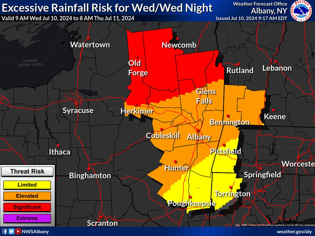
The expected high for Wednesday is 90, with a heat index (real feel) close to 100 degrees. The heaviest rain, up to 3 inches is possible in the Glens Falls-Lake George area.
Thunderstorms and damaging winds are expected throughout the area and the potential for a tornado can't be ruled out.
 The Gold Gala - A Uplifting Night For An Amazing Cause
 Vote Now For Final Round of SUNY's Mascot Madness
 5 Below Opening a New Store in the Capital Region
 Long Vacant Queensbury Sears to Become Indoor Race Track
 George Jones & Tammy Wynette's Daughter Georgette Jones In Cohoes, NY